Atlas of North Rhine-Westphalia
|
||
Route Planning Software see GermanyAerial Pictures see GermanyGeoportalAtlas of Regional StatisticsAdministration
EducationElections
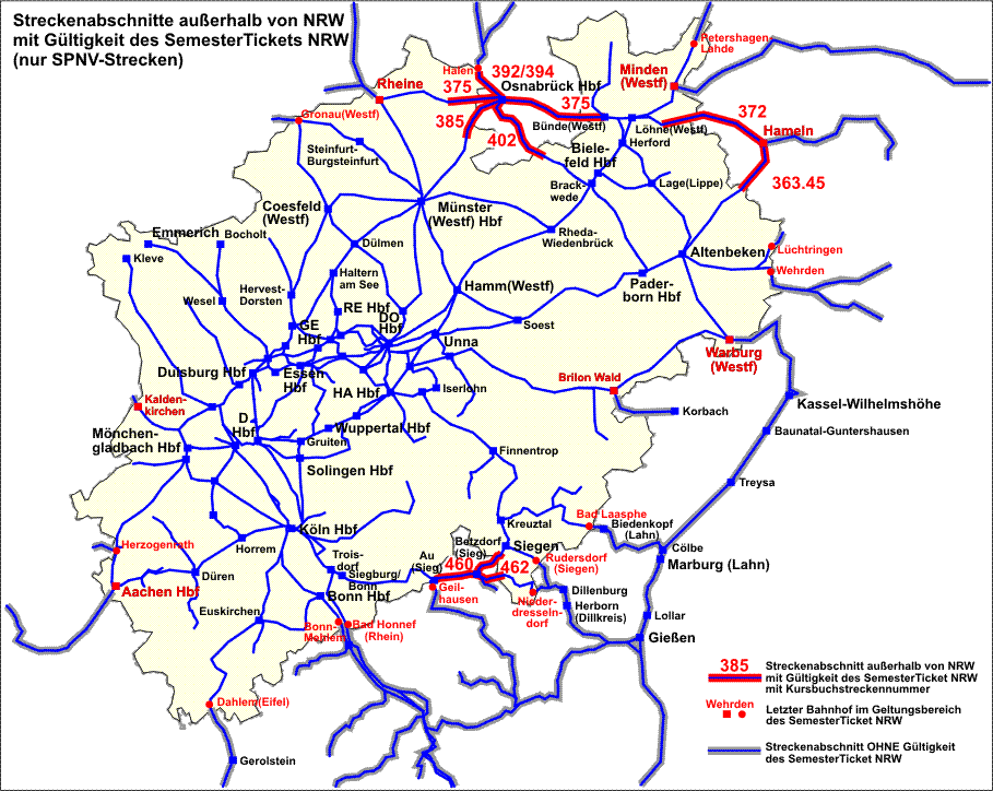
Traffic
|
Topography, Geology, Tectonics etc.ClimateEnvironmental Protection and Ecology
Agriculture and ForestryInfrastructure |
Tourist Maps, Recreation and LeisureEconomyUnemploymentJusticeReligion and ChurchesDialectsHistory |
|
|
|
|
|
* This is a link collection, so I can neither guarantee that the linked maps are always or will be always available nor can I be made responsible for the contents of the maps. I try to keep this list up-to-date. Thomas Höckmann - April 2009 |
||


