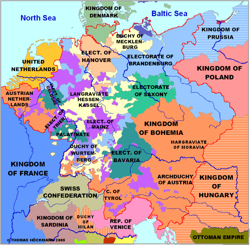
Historical maps - Germany at the end of the 18th century
Historische Karten - Deutschland am Ende des 18. Jahrhunderts
Cartes historiques - L´Allemagne à la fin du XVIIIe  siecle

Anklicken zum Vergrößern - Click to enlarge - Cliquez pour agrandir

Germany - Atlas - Deutschland Atlas - Atlas Allemagne


Photos from the region

Germany - Start

Baden-Württemberg South

Baden-Württemberg North

Bavaria

Bavarian Swabia

Swabia North

Brandenburg

Hesse North

Hesse South

Mecklenburg

Lower Saxony

Northrhine-Westphalia

Palatinate

Pomerania

West and East-Prussia

Rhineland-Palatinate

Saarland

Saxony

Silesia

Schleswig-Holstein

Thuringia

Limburg

Luxembourg

Flanders

Lorraine

Alsace South

Tyrol

Austria

Baltic Countries

Sitemap

Abbreviations

recommended books

© Thomas Höckmann

Historical Atlas box

Periodical Historical
Atlas of Europe
English Version

21 Maps of Europe
one for each Century
more
Austria Schleswig-Holstein Mecklenburg Pomerania Prussia Brandenburg Silesia Saxony Tyrol Austria Austria Austria Bavaria Northern Hesse Rhineland-Palatinate Northrhine-Westphalia Northrhine-Westphalia Southern Baden-Wurttemberg Northern Baden-Wurttemberg Palatinate Lorraine Alsace

Startseite

info@hoeckmann.de

Impressum/Disclaimer Sitemap

02.08.18 © Höckmann

www.ruhr-projekt.de