interaktive Karte - interactive map - carte interactive
Photos from the region
Germany - Start
Baden-Württemberg South
Baden-Württemberg North
Bavaria
Bavarian Swabia
Swabia North
Brandenburg
Hesse North
Hesse South
Mecklenburg
Lower Saxony
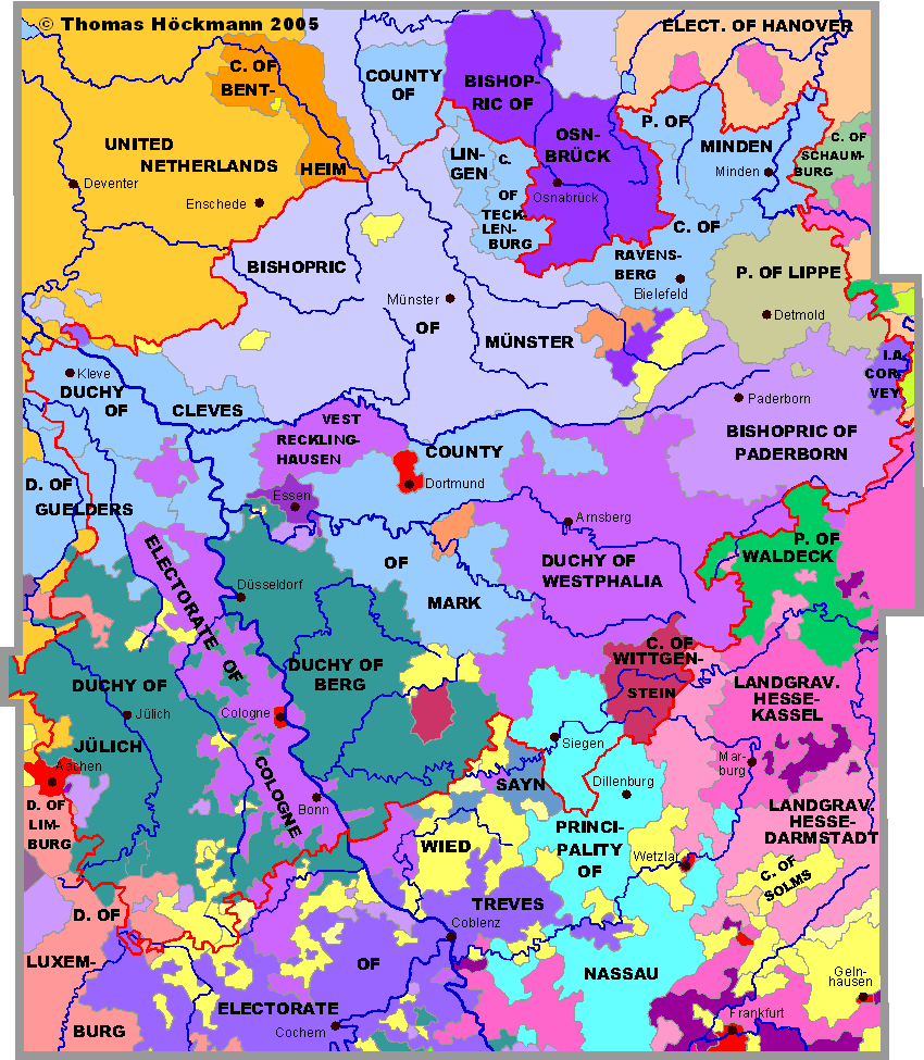
Northrhine-Westphalia
E. of Cologne
D. of Cleves
B. of Münster
P. of Lippe
B. of Paderborn
D. of Westphalia
P. of Nassau
Ruhr-Area
Palatinate
Pomerania
West and East-Prussia
Rhineland-Palatinate
Saarland
Saxony
Silesia
Schleswig-Holstein
Thuringia
Limburg
Luxembourg
Flanders
Lorraine
Alsace South
Tyrol
Austria
Baltic Countries
Sitemap
Abbreviations
recommended books
© Thomas Höckmann
Startseite
info@hoeckmann.de
07.07.25 © Höckmann